
Bushveld Igneous Complex
Geologic Map and Stratigraphy
Elizabeth A. Johnson
Geologic Map
Figure 1 shows the sample locations for this lab. Figure 1 is an excerpt from the Bushveld Igneous Complex Map (Figure 2).
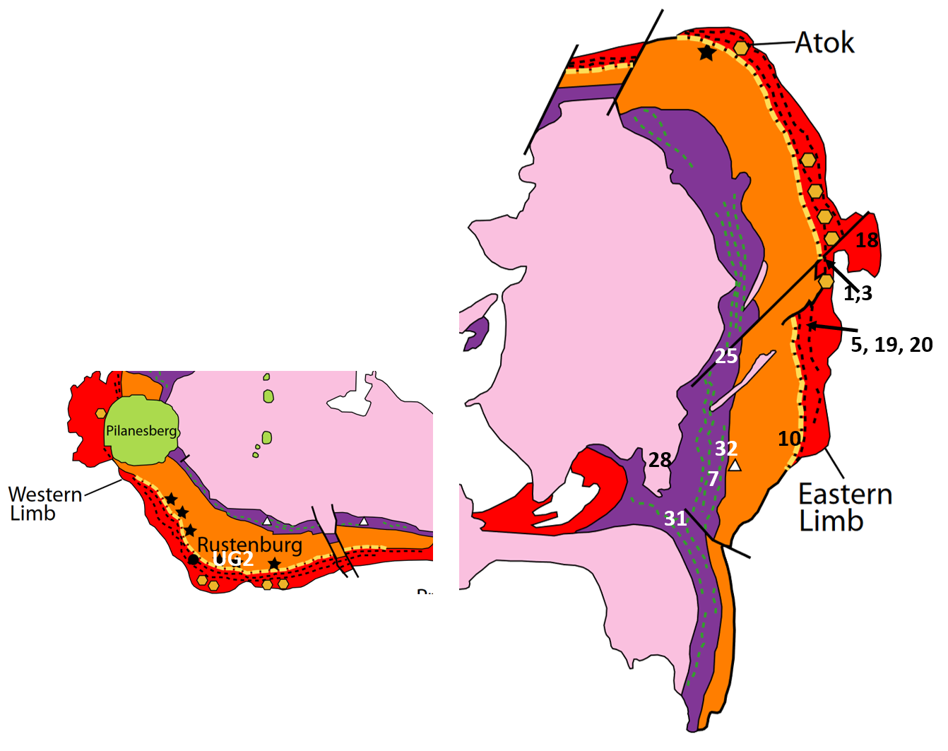

Figure 2. Bushveld Igenous Complex. Click on the image to link to the full size map.
By Taylor, C.D., Schulz, K.J., Doebrich, J.L., Orris, G.J., Denning, P.D., and Kirschbaum, M.J. – Geology and nonfuel mineral deposits of Africa and the Middle East, USGS Open-File Report 2005-1294-E, Public Domain, Link
Stratigraphy

Figure 3. Stratigraphy of the Bushveld Igneous Complex.
Michael L. Zientek, J. Douglas Causey, Heather L. Parks, and Robert J. Miller / Public domain, Link
Reference
https://en.wikipedia.org/wiki/Bushveld_Igneous_Complex
Media Attributions
- Bushveld Sample Locations adapted by Elizabeth Johnson is licensed under a Public Domain license
