16 Applications: Plate Tectonics
Elizabeth Johnson
Learning Objectives
Students will be able to:
- Describe the changes in the elevation and slope of the surface of Earth across different types of plate boundaries and continental or oceanic crust.
- Determine the type of plate boundary based upon a cross-section of topography and bathymetry.
Plate Boundaries
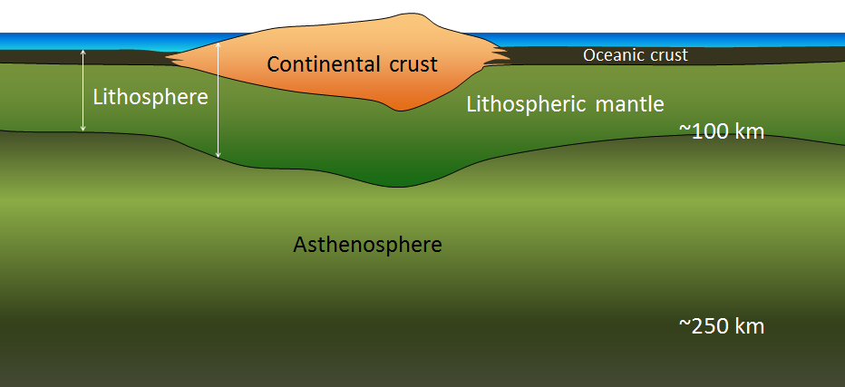
The tectonic plates are pieces of the lithosphere that move relative to each other over the surface of Earth. The lithosphere includes continental crust, oceanic crust, and the uppermost part of the mantle:
There are three main types of boundaries between plates: divergent, convergent, and transform boundaries.
Divergent Boundaries
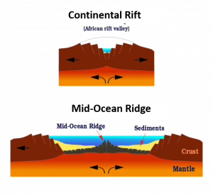
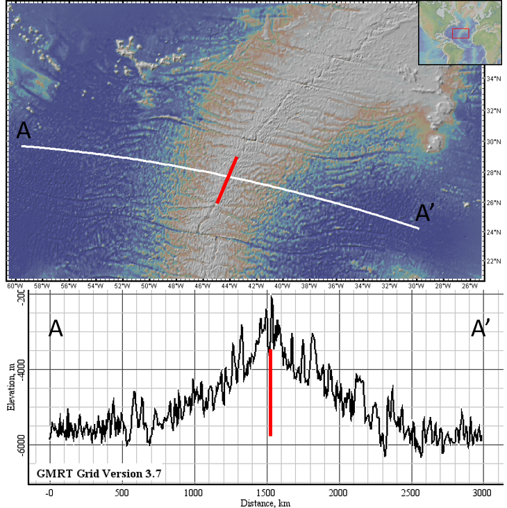
Divergent plate boundaries are where two plates move apart from each other. Divergent boundaries can occur in the ocean, at mid-ocean ridges, or on the continents where they form continental rift zones. Continental rifts form valleys as the plates thin and split at the boundary. Mid-ocean ridges are volcanoes, and the hot new oceanic crust formed from magma at the plate boundary is expanded from the heat. Divergent boundaries in the oceans look like enormous symmetric mountain ranges.
COnvergent Boundaries
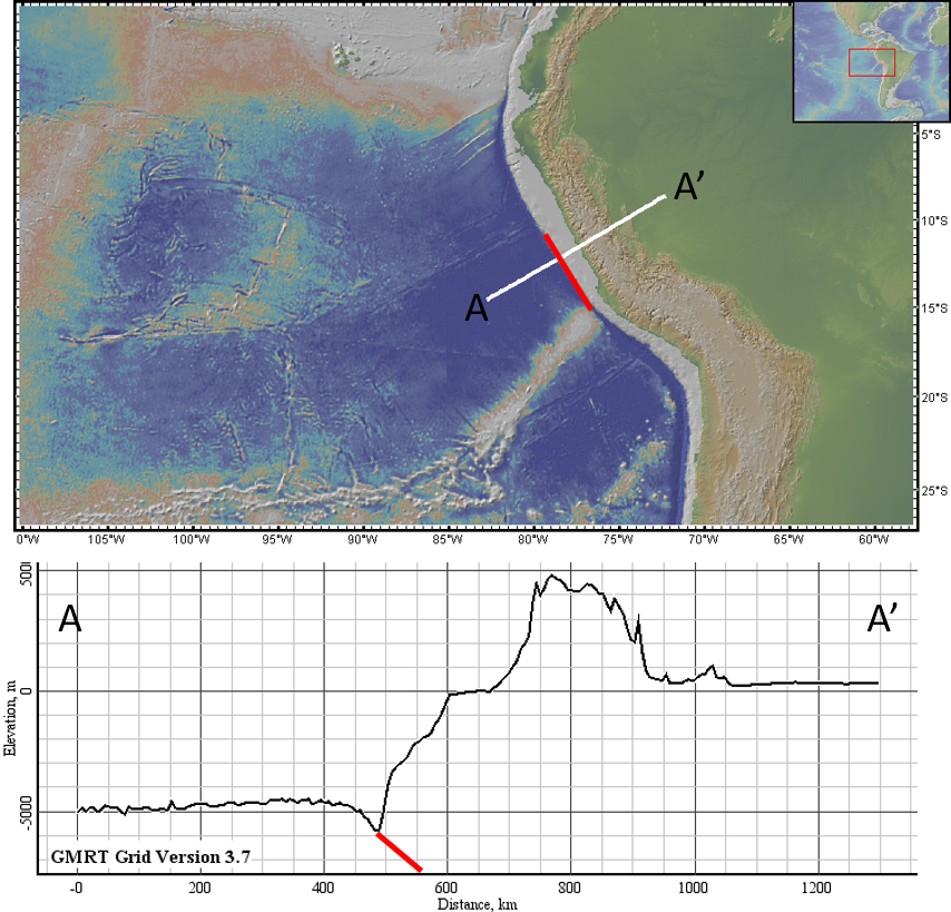
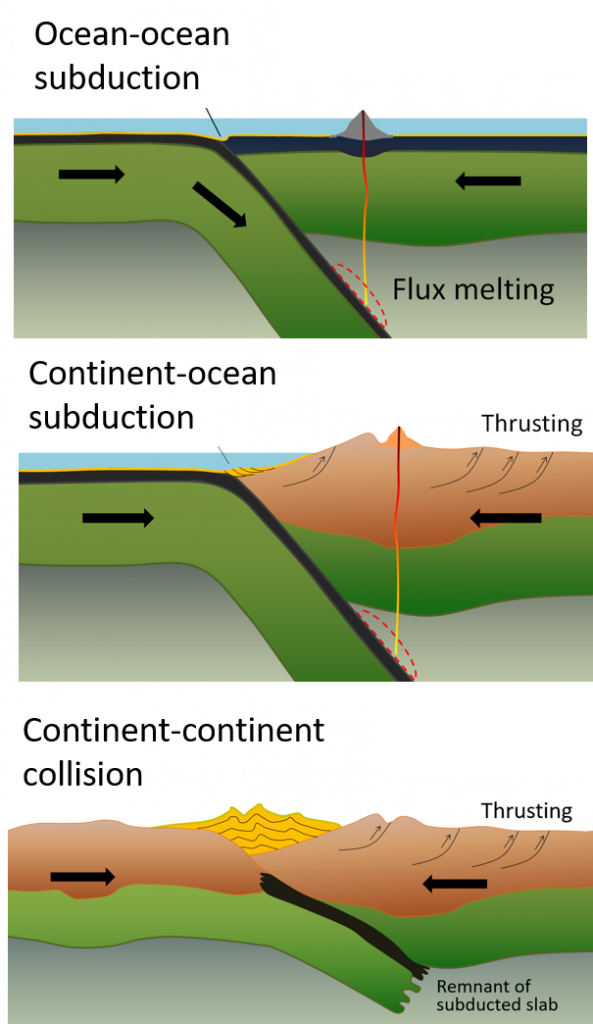
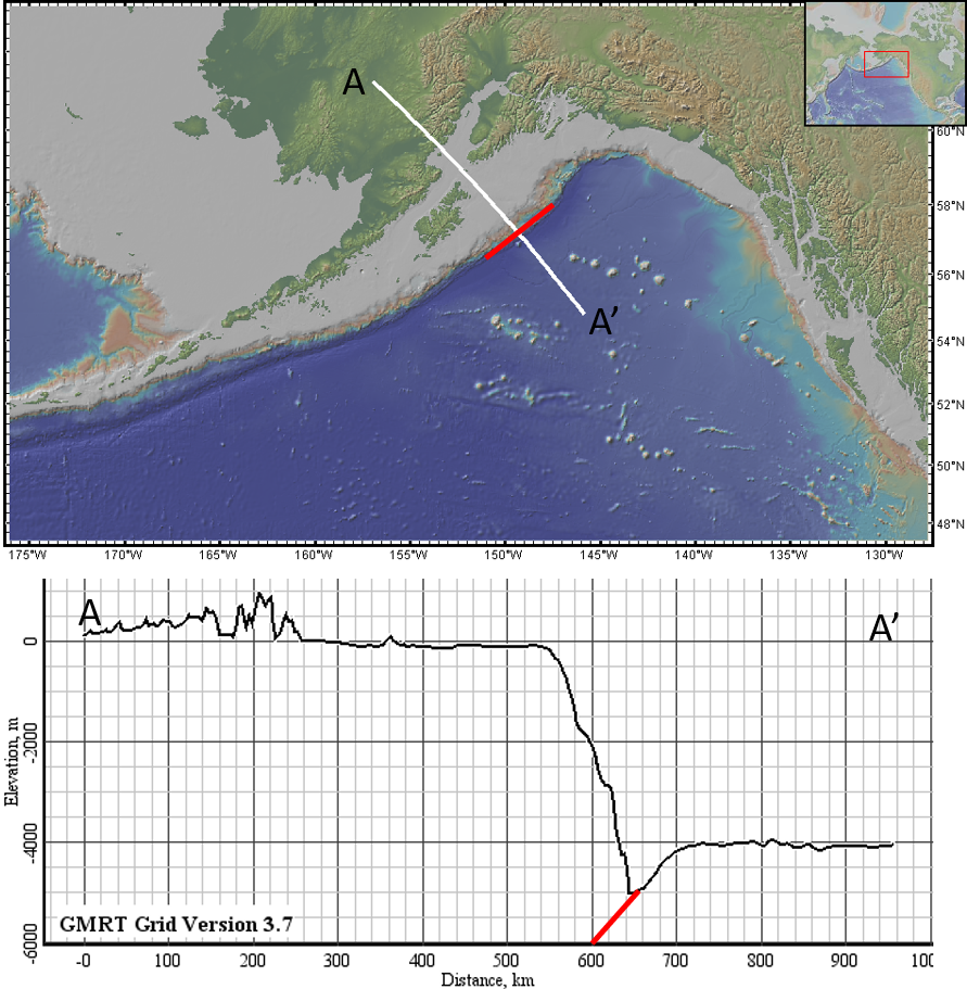
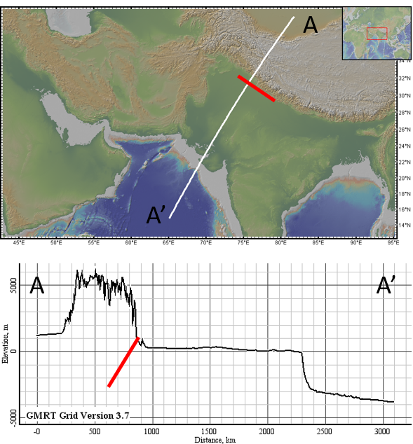
Convergent plate boundaries are where two plates are moving towards each other. When one plate is pushed under another at a convergent boundary, subduction occurs. The subducted plate pulls down the ocean floor where it is sinking into the Earth, forming a trench or linear depression on the ocean floor. The difference in elevation between continental and oceanic crust can clearly be seen in ocean-continent subduction zones. Where two continents collide, large mountain belts form around the plate boundary.
Transform Boundaries
Transform boundaries are where two plates move alongside each other. Because the plates are moving alongside each other, theoretically there should be no change in topography from one plat to another, because the plates are neither pulling apart nor colliding at this type of boundary. In reality, though, transform boundaries are usually not perfect, meaning they are a combination of transform and convergent boundaries, or of transform and divergent boundaries. So, there can be some changes in topography on either side of a transform boundary, although it is not as large as changes in topography across other types of boundaries.
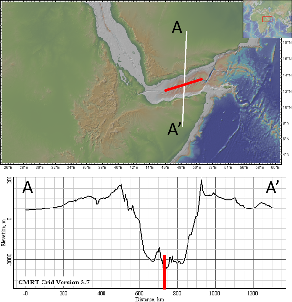
Which Type of Boundary Is It?