
47 Geologic Map of North America
Elizabeth Johnson
Generalized Geologic Map of North America
This image is a generalized geologic map of all of North America. Each major rock formation or unit is a different color. In a map of such a large area, individual rock layers cannot be shown, so the rock units are generally grouped by age and/or type. Click on the image to enlarge.
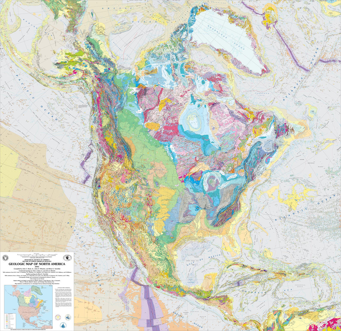
https://www.usgs.gov/media/images/geologic-map-north-america
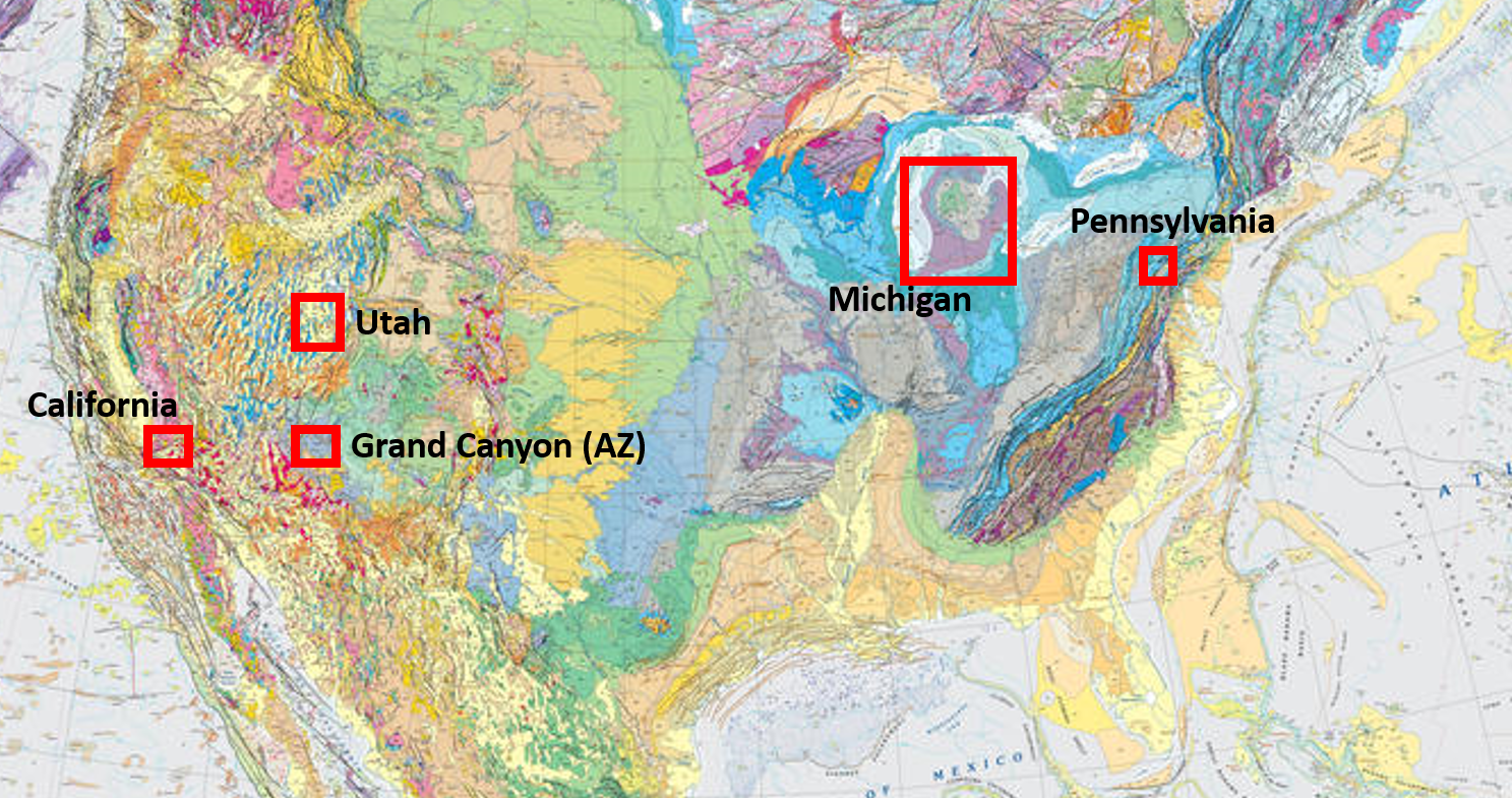
Map Locations for this Module
This excerpt of the map from above shows the approximate locations of the maps we will look at for this lab.
Find Geologic Maps Where You Live
Are you interested in locating geologic maps from where you live (or other interesting places)? All maps created by the US Geological Survey and State surveys are free to the public. You can search by area here:
https://ngmdb.usgs.gov/ngm-bin/ngm_compsearch.pl
