
49 California
Elizabeth Johnson
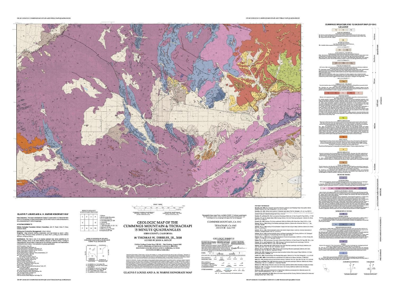
Geologic map of the Cummings Mountain and Tehachapi 15 minute quadrangles, Kern County, California
Use this link to zoom in and pan around the map:
https://ngmdb.usgs.gov/ngm-bin/pdp/zui_viewer.pl?id=34694
link to the map page: https://ngmdb.usgs.gov/Prodesc/proddesc_86304.htm
Questions
- What type of rock is unit ms?
- schist
- limestone
- gneiss
- granite
2. How old is unit qd?
- Paleocene
- Mesozoic
- Precambrian
3. What type of fault is the Garlock Fault? Reminder of fault types: Faults
- Normal
- Reverse
- Left-lateral strike-slip (transform)
- Right-lateral strike-slip (transform)
4. Based upon your answer to the question above, did this area experience compression, tension, or shear? Reminder: Geologic Structures and Plate Tectonics
- Compression
- Tension
- Shear
Want to know more about this fault? See this page for more information: https://scedc.caltech.edu/significant/garlock.html
