
51 Utah
Elizabeth Johnson
Geologic map of the Pine Grove-Blawn Mountain area, Beaver County, Utah.
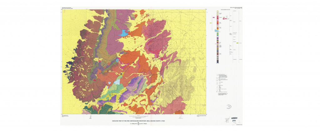
Use this link to zoom in and pan around the map: https://ngmdb.usgs.gov/ngm-bin/pdp/zui_viewer.pl?id=426

Use this link to zoom in and pan around the cross-sections, which also includes detailed descriptions of the rock units: https://ngmdb.usgs.gov/ngm-bin/pdp/zui_viewer.pl?id=427
This is the link to the page for the Geologic map of the Pine Grove-Blawn Mountain area, Beaver County, Utah: https://ngmdb.usgs.gov/Prodesc/proddesc_9255.htm
Questions
There is a lot going on in this map! But we will focus on specific parts for each question.
8. Locate the Wah Wah syncline (left / west side of map) and the Wah Wah thrust fault (center of map).
The Wah Wah syncline and thrust fault are indications that this area experienced which type of plate tectonic force in the past?
- Compression
- Tension
- Shear
Now locate this fault on the map and cross-section (tan arrows point to the fault – we will call it the “tan arrow fault”):
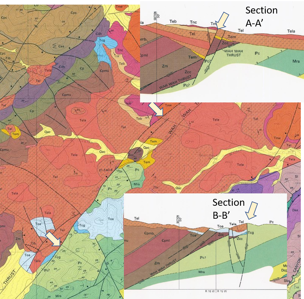
9. Rock unit Pc is _______ than rock unit Tel. Hint: use the map key.
- younger than
- older than
10. Cross-section B-B’ shows that the Tel side of the “tan arrow” fault is the hanging wall. Given your answer above, and the information in B-B’, what type of fault is this? (Hints: look at the cross-section and Faults)
- Normal
- Thrust (reverse)
- Strike-slip
11. Cross-section A-A’ shows the intersection of the Wah Wah thrust fault (below the brown Zcc unit) and the “tan arrow” fault. Based upon Principles of Relative Dating, which fault happened last?
- Wah Wah Thrust
- Tan Arrow Fault
12. The Tan Arrow Fault (and many other faults in the area of the same type) indicate that this area experienced which type of plate tectonic force?
- Compression
- Tension
- Shear
Want to know more? This area of Utah is part of the Basin and Range Province.
The connection between the San Andreas and the Basin and Range is illustrated in this video: (watch from the beginning to 4:07 minutes): https://youtu.be/2TSTVCIZ-dg
The connection between the San Andreas fault system and the Basin and Range is described in detail in this page: https://opengeology.org/historicalgeology/san-andreas-fault-and-basin-and-range/
